


UNION CITY TWP Voting District, Allamakee County, Iowa
About
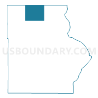
Outline

Summary
| Unique Area Identifier | 581385 |
| Name | UNION CITY TWP Voting District |
| County | Allamakee County |
| State | Iowa |
| Area (square miles) | 30.71 |
| Land Area (square miles) | 30.68 |
| Water Area (square miles) | 0.02 |
| % of Land Area | 99.92 |
| % of Water Area | 0.08 |
| Latitude of the Internal Point | 43.47137280 |
| Longtitude of the Internal Point | -91.42621370 |
Maps


Graphs
Select a template below for downloading or customizing gragh for UNION CITY TWP Voting District, Allamakee County, Iowa


Neighbors
Neighoring Voting District (by Name) Neighboring Voting District on the Map
- Eitzen Voting District, Houston County, MN
- FRENCH CREEK TWP Voting District, Allamakee County, IA
- HANOVER TWP Voting District, Allamakee County, IA
- IOWA TWP Voting District, Allamakee County, IA
- Jefferson Twp. Voting District, Houston County, MN
- LANSING TWP Voting District, Allamakee County, IA
- WATERLOO TWP Voting District, Allamakee County, IA
- Wilmington Twp. Voting District, Houston County, MN
- Winnebago Twp. Voting District, Houston County, MN
Top 10 Neighboring County Subdivision (by Population) Neighboring County Subdivision on the Map
- Lansing township, Allamakee County, IA (1,424)
- Iowa township, Allamakee County, IA (744)
- Wilmington township, Houston County, MN (434)
- Waterloo township, Allamakee County, IA (266)
- Eitzen city, Houston County, MN (243)
- Winnebago township, Houston County, MN (240)
- French Creek township, Allamakee County, IA (225)
- Union City township, Allamakee County, IA (219)
- Hanover township, Allamakee County, IA (193)
- Jefferson township, Houston County, MN (129)
Top 10 Neighboring Place (by Population) Neighboring Place on the Map
Top 10 Neighboring Unified School District (by Population) Neighboring Unified School District on the Map
- Allamakee Community School District, IA (8,992)
- Caledonia Public School District, MN (6,077)
- Eastern Allamakee Community School District, IA (2,730)
Top 10 Neighboring State Legislative District Lower Chamber (by Population) Neighboring State Legislative District Lower Chamber on the Map
Top 10 Neighboring State Legislative District Upper Chamber (by Population) Neighboring State Legislative District Upper Chamber on the Map
Top 10 Neighboring 111th Congressional District (by Population) Neighboring 111th Congressional District on the Map
Top 10 Neighboring Census Tract (by Population) Neighboring Census Tract on the Map
- Census Tract 209, Houston County, MN (3,883)
- Census Tract 9602, Allamakee County, IA (2,591)
- Census Tract 9601, Allamakee County, IA (2,130)